What school district is Kemmer View Estates (KVE) in?
KVE is located within the Beaverton School District, specifically; Cooper Mountain Elementary, Highland Park Middle School, and now the new Mountainside High School (Home of the Mavericks).
Is KVE located in Beaverton?
In the suburbs of Portland, KVE is located just West of the Beaverton city limits, and East of Hillsboro. It is technically located in "unincorporated" Washington County, in an region called Aloha. The zip code for the homes in this area is 97007, and is serviced by the Aloha Post Office. Law enforcement services are provided by Washington County Sheriff's District. Tualatin Valley Fire & Rescue Station number 69 is located less than a half mile South from KVE on 175th Ave.
What is the development history of KVE?
Located on top of Cooper Mountain, Kemmer View is composed of 91 residential lots and a commonly owned forest / greenspace. The lots are divided into 3 phases. Phase 1 consists of 40 lots located to the East of the greenspace. Phase 2 are the initial Western most 18 lots established for the 1988 Street of Dreams' homes. Phase 3 are the remaining 33 homes that build out the remaining West side of KVE. Most of the home construction in KVE was completed by 1996, although a couple of homes were more recently finished as late as 2005.
Does Kemmer View Estates have a Homeowner's Association?
Yes, KVE has maintained a Homeowner’s Association since 1990. Currently, we have 7 Board Directors that meet approximately every 6 weeks to review the current budget and to get updates from each Board Director working on special projects. The HOA is responsible for maintaining the overall neighborhood design integrity, promoting strong property value, addressing landscape care at the boundaries of the neighborhood, the maintenance of our privately owned forest and greenspace, as well as aiding in other community building events. Meeting minutes are available upon request.
Was Kemmer View Estates a former Street of Dreams neighborhood?
Yes, in 1988 18 initial lots (Phase II) were developed in KVE for the Steet of Dreams show. In 2003 the Street of Dreams returned to Cooper Mountain and was established on the roads directly below the homes in Phase 3 of KVE.
What is the official altitude or height of Cooper Mountain?
Current GPS units state Cooper Mountain is at its highest point 801' -- found at Latitude 45.452401 along Longitude 122.863807. Topography maps indicate just over 780'. See official topography map of Cooper Mountain »
How did Cooper Mountain get its name?
Early Pioneers and Settlers began sweeping through the area in 1840's, but one of the first to make a land claim on the slopes of this mountain was Perry Cooper in 1853. Read more »
Life on top of Cooper Mountain
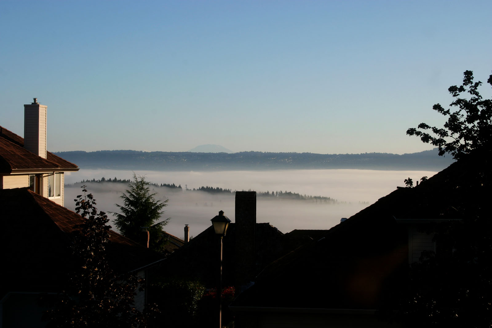
One of the interesting things new homeowners often discover at 770+ feet up, is just how different the climate can be. Often waking to gorgeous morning sunrises above the cloud and fog layer, occasionally socked right in the thick of the sweeping clouds.
Often windy, and certainly more harsh in the winters, temperatures usually are 3 to 7 degrees cooler than on the valley floor. If there is a threat of snow, you'll usually find it here first. And when there is snow at the valley floor, you can expect 2 to 4" more at the top.
Summers are less intense often cooled with a gentle breeze, Spring starts a couple weeks later, and Fall starts a little sooner on the mountain, but one thing is for sure... the four mountain views (Mt Rainier, Mt. Saint Helens, Mt. Adams, and Mt Hood) are fantastic to look at year-round!
Looking for some fun indoor Kemmer View fun?
See our collection of puzzles and mazes »